If the Peloponnese region of southern Greece is like the palm of a hand then the Mani Peninsula is the middle finger. Pointing southwards into the Mediterranean, it is a bony extension of the Taiyetos Massif, which prises Messenia apart from Laconia. At the northern edge of the region are two towns of note: Kalamáta lies to the west of the Taiyetos, at the head of the Gulf of Messenia; on the east side lies the inland city of Sparta.
Although the mountains have always kept Mani remote, outsiders have long coveted the place. For centuries it attracted refugees from elsewhere in Greece, as well as foreign interlopers drawn by its strategic location on the trade routes to North Africa, Italy and the Levant. Despite this, the Maniátes themselves have always gone their own way, creating a cultural landscape that is today unique in Greece.
Until recently visitors to Mani faced a long overland journey from Athens or Patras. Nowadays, however, they can arrive by plane in Kalamáta. It’s still an adventure though as the runway is barely a quarter the length of those elsewhere, and instead of a sleek terminal there are dense reed beds alive with birds and butterflies.
Although the mountains have always kept Mani remote, outsiders have long coveted the place.
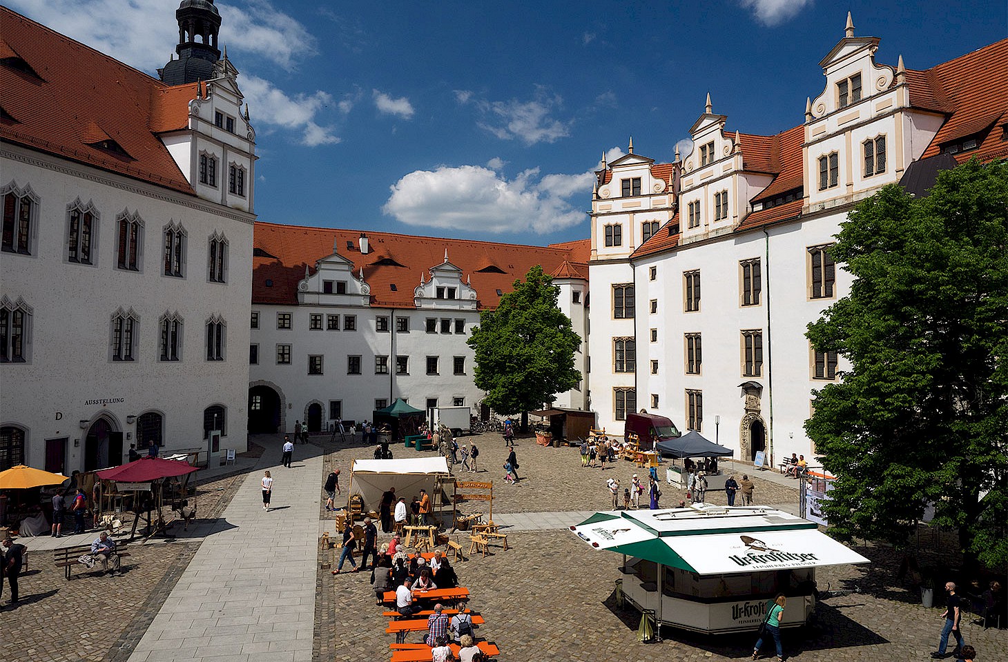
One might easily be waylaid by Kalamáta’s renowned olives and oil, its silk kerchiefs and the joyous Kalamatianós folk dance — but the road beckons. Geographically the city lies at the edge of Exo (Outer) Mani, which faces westwards into the Gulf of Messenia and reaches as far south as Ítilon Bay. The coastal plain is rich and fertile here, and capable of supporting a significant population. Many live just thirty-five kilometres away in the welcoming seaside town of Kardamíli.
There’s long been a cosmopolitan air about Kardamíli despite electricity having only arrived in 1969. Handsome houses line the main street, their living rooms adorned with foreign antiques brought up from the town’s harbour, much prized since the time of the ancient Spartans. The newsagent’s shop is piled high with literature and the kafenia buzz with thoughtful conversation. It's little wonder that twentieth-century Kardamíli became a magnet for artists, most famously the British travel writer Patrick Leigh Fermor (1915– 2011). A mix of Graham Greene, James Bond and Indiana Jones, Leigh Fermor built a home for himself here in the 1960s, on the foreshore just south of the harbour. With its library, cloister-like veranda and garden tumbling down to the beach it remains the quintessential writer’s abode.
Of the many luminaries to visit Leigh Fermor the most colourful was fellow travel writer Bruce Chatwin. He lodged in a guest house on the roadside (now the Hotel Kalamítsi) where proprietors Nikos and Thea Ponireas still recall him asking for bean soup as sustenance whilst writing The Songlines. When not writing he was striding out across the Taiyetos along ancient mule tracks known as kalderímia. It seems entirely fitting that, after Chatwin succumbed to AIDS in 1989, Leigh Fermor spread his ashes outside the tiny Chapel of St. Nicholas in Chóra in the foothills above Kardamíli.
Land of evil counsel
From Kardamíli the coast road winds south passing the village of Stoupa, where in 1917 Greek writer Nikos Kazantzakis encountered Giorgis Zorbas, creating a literary legend in the process — although Zorba the Greek is set in Crete rather than Mani.
Some way south of Kardamíli, the road then swerves inland taking in a series of ancient settlements built here to avoid the predations of maritime raiders. Amongst them is sleepy Nomitsí. That no-one is home is less about the midday heat and more about depopulation. Life has always been hard in Mani and since the Second World War if a better life could be found in Kalamáta then so be it. For the two hundred souls living in Nomitsí today there are now five churches.
The road eventually drops down to Ítilon Bay, gateway to Mesa (Deep) Mani. This rugged and desolate region fully warrants its reputation as being a place where God grew stones. It also revels in the sinister name of Kakavoúlia, or ‘Land of Evil Counsel’, recalling a long history of piracy, families feuding over limited resources, and an appetite for xenophobia.
On the waterfront in pretty Liméni this troubled past confronts the modern face of Mani. A smart hotel occupies what was once the fortified tower house of the Mavromichális clan, who arrived here as refugees in the 1450s to evade Turkish oppression. Such towers punctuate Mesa Mani and were used not only as a defence against outsiders but also in longrunning blood feuds between Maniate f amilies.
In 1770 Russian forces landed at Liméni in an abortive attempt to help the Greeks overthrow their Ottoman yoke. Many clan members gave their lives in the fight for freedom until it was eventually secured by Pétros Mavromichális (1765– 1848). By reuniting the warring families of Mesa Mani he was able to pose a threat serious enough for the Sultan to grant him the beydom — but it didn’t stop there. On 17 March 1821 Petróbey raised the Greek flag in nearby Areópolis, thus effectively kick-starting the Greek War of Independence.
After so much modern history the Glifáda Caves a short distance away in Díros Bay bring the visitor face to face with the earliest Maniátes. They were Neolithic folk whose effects have been uncovered in a series of spectacular flooded caverns that can be visited by boat.
Across the great cape
From Díros Bay the road continues in a dead straight line. It might seem there is little to see here but hidden amongst the rocks are some gems in Mani’s treasury of Byzantine churches. Strung out like beads in a necklace their presence is often betrayed by little more than a stand of ink-black cypress trees or a tangle of prickly pear. Despite many of these churches being in a ruinous state they contain the most exquisite frescoes.
As one travels deeper into Mani, the peninsula inevitably narrows. At Mézapos Bay however, a deep-water harbour mentioned by Homer, the process reverses for a while, as the coastline bulges westwards to form the Cávo Grósso. The towering cliffs of this great cape are still feared by local fishermen, whose clan forebears, the Sássarians, were once the scourge of the occupying Turks. Their brave exploits are recorded in Mani’s poetic funeral laments known as mirolóyia.
Before crossing the cape a detour should be made to the promontory at Tigáni, where a jumble of ruins witness a Bronze Age settlement that became a Byzantine fortress — Castle Maina — whence the name Mani may be derived (others subscribe to a Doric etymology meaning ‘wild’, hence the English word ‘mania’, which some would say befits the Maniátes of yore). From Tigáni the cliffs of the Cávo Grósso loom monstrously. A track winds hesitantly towards them, at the end of which is perched the remote thirteenth-century Church of Odiyítria (Our Lady of the Way). Lashed by storms and barely accessible it still draws worshippers, testament to the elemental faith of Maniátes past and present.
Back on the road it’s southwards once more, across the cape itself. Ruined towers and churches abound despite the land being largely waterless. Security was everything in an age when danger was omnipresent, and so the Maniátes used the cape as a natural bastion. Further inland the stony ground is in part cultivable which explains the presence of a significant town, ‘Kítta of the many towers’. Mani’s last great inter-family feud occurred here in 1870, so any squabbling these days is restricted to its pair of competing mini-markets!
The distant echo of blood-letting also resonates beyond the cape at Yerolimín, a har bour established as an entrepôt by a local merchant only a century ago. One of his former warehouses is now the Kyrimai Hotel alongside which is the deliberately similar-sounding Kyrimi Guest House. Two feuding brothers are allegedly the cause of this confusion, exchanging their yataghans and muskets of old for a modern war of words.
Up from Hades
Climbing again into the hills the road reaches the village of Váthia. Clustered along a steep and windswept ridge its tower houses appear like some abandoned Mediterranean Camelot. When the English topographer Martin Leake passed this way in 1805 on his tour of the Peloponnese he witnessed the tail end of a vendetta lasting an incredible forty years. A hundred villagers lost their lives, but it seems not in vain since the combatants periodically joined forces to repel their common enemy, the Turks, their constant fighting ensuring a permanent state of readiness. The towers of Váthia are crumbling now, more evidence of the depopulation that has blighted Mesa Mani in recent decades. Although largely deserted today, this eerie place still conjures up better than anywhere else the dogged mediaevalism of the Maniátes, which almost endured into modern times.
After Váthia the road disappears quickly behind a bluff and then plunges down towards a narrow isthmus. On the east side is Pórto Káyio, once an important naval base coveted by both Turks and Venetians. The Italians called it Porto Q uaglio on account of the migrating quails netted here for a once lucrative export trade. Much later the bay witnessed frantic efforts to evacuate British troops ahead of the German invasion of Greece.
Now the road mounts one final head land, the craggy swansong of the Taïyetos. For the visitor Mani rarely gets more dramatic as the sea on either side seemingly pinches the peninsula upwards into a serrated scarp. The ancients were similarly impressed by this otherworldly landscape and built a sanctuary to Poseidon here with facilities for pilgrims. Its broken remains encircle Asómati Bay and include a smoke-blackened cave through which Heracles is said to have hauled the hellhound Cerberus up from Hades.
A half hour’s stiff walk from here reveals the lonely lighthouse at Cape Ténaron (or Matapán as it is often known), where the Taïyetos disappears forever beneath the sea. This is the southernmost point not only of Mani but also the Balkans and, except for a scattering of small islands, there is only sea now between here and North Africa.
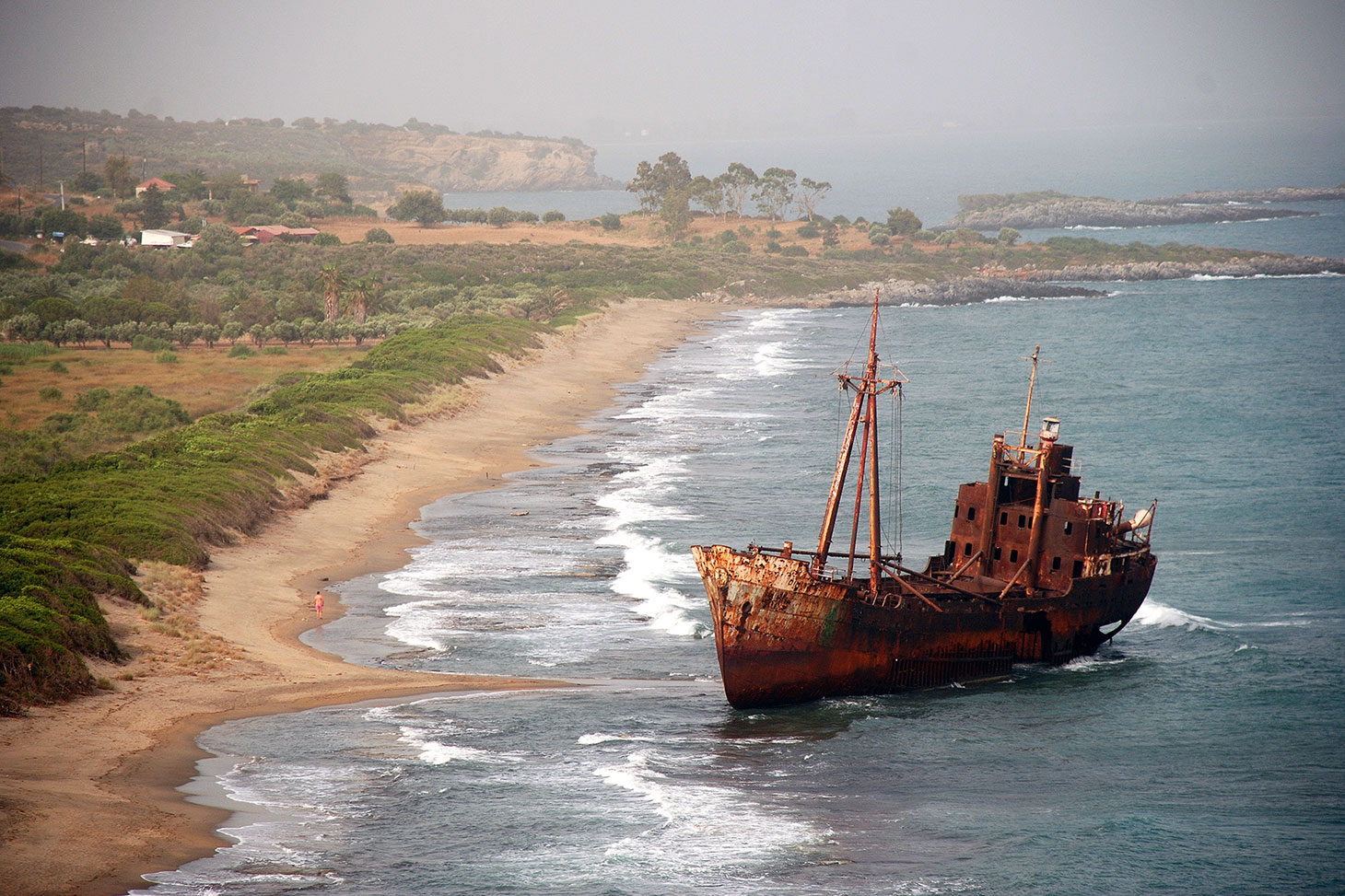
A ship run aground on the ruins of ancient Yíthion (photo © Duncan JD Smith).
The sunward coast
Back at Pórto Káyio the return to civilisation can be made up the east coast. Facing into the Laconian Gulf this is Kato (Lower) Mani, the Sunward Coast, where the stern headlands of Mesa Mani give way to a procession of lovely bays scooped out of the now gently sloping landscape. Traditional Maniáte architecture remains dominant though, notably in the sun-baked villages of the coastal strip: Láyia, Nímfi, Flomochóri. Láyia’s Dr. Papadákis is still remembered for his treatment of the casualties of Mani’s clan warfare. Between 1715 and 1768 he treated some seven hundred patients from forty-two villages.
Sandy beaches and fish tavernas attract pleasure-seekers to this part of Mani, and the harbour at Kótronas is no exception. They’ve been coming here since Pausanias promoted the place (known then as Teuthrone) to Roman tourists in his Guide to Greece. Two millennia have done little to diminish the simple pleasures of dining on fresh fish beneath the shade of a plane tree.
After skirting around Skoutári Bay the road reaches Yíthion, the eastern gateway into Mani. This bustling port with its corniche of neo- Classical buildings first came to prominence when Rome defeated Philip V of Macedon in 196 BC, making it the head of a league of free Laconian cities to counter-balance the waning might of Sparta. A golden age ensued that was unbroken until the arrival of the Visigoths and then the Slavs several centuries later.
Of ancient Yíthion little survives since much of it has been built over. In the bay immediately north, however, ruined walls can still be seen trailing off into the sea on which the rusting hulk of a freighter has been snagged since 1981. And at the opposite end of town lies the tiny island of Kranáï, where Paris and Helen spent their first night of love after an elopement that prompted the Trojan War.
Two roads strike out from Yíthion, giving options for the return to Kalamáta. One snakes generally south-west across the Taïyetos to Areópolis by way of a defile guarded by the formidable Passavá Castle. The “pas avant” of the Franks, it was commissioned in 1220 as part of yet another attempt to tame wild Mani. At Areópolis, one then turns north for Kalamáta.
The other road takes a more direct route skimming the region known as Vardoúnia. No less dramatic, the road climbs steeply northwards through forests of Greek Fir and Black Pine before eventually swooping down towards Sparta — and home. It is a suitably thrilling end to this Mani odyssey.